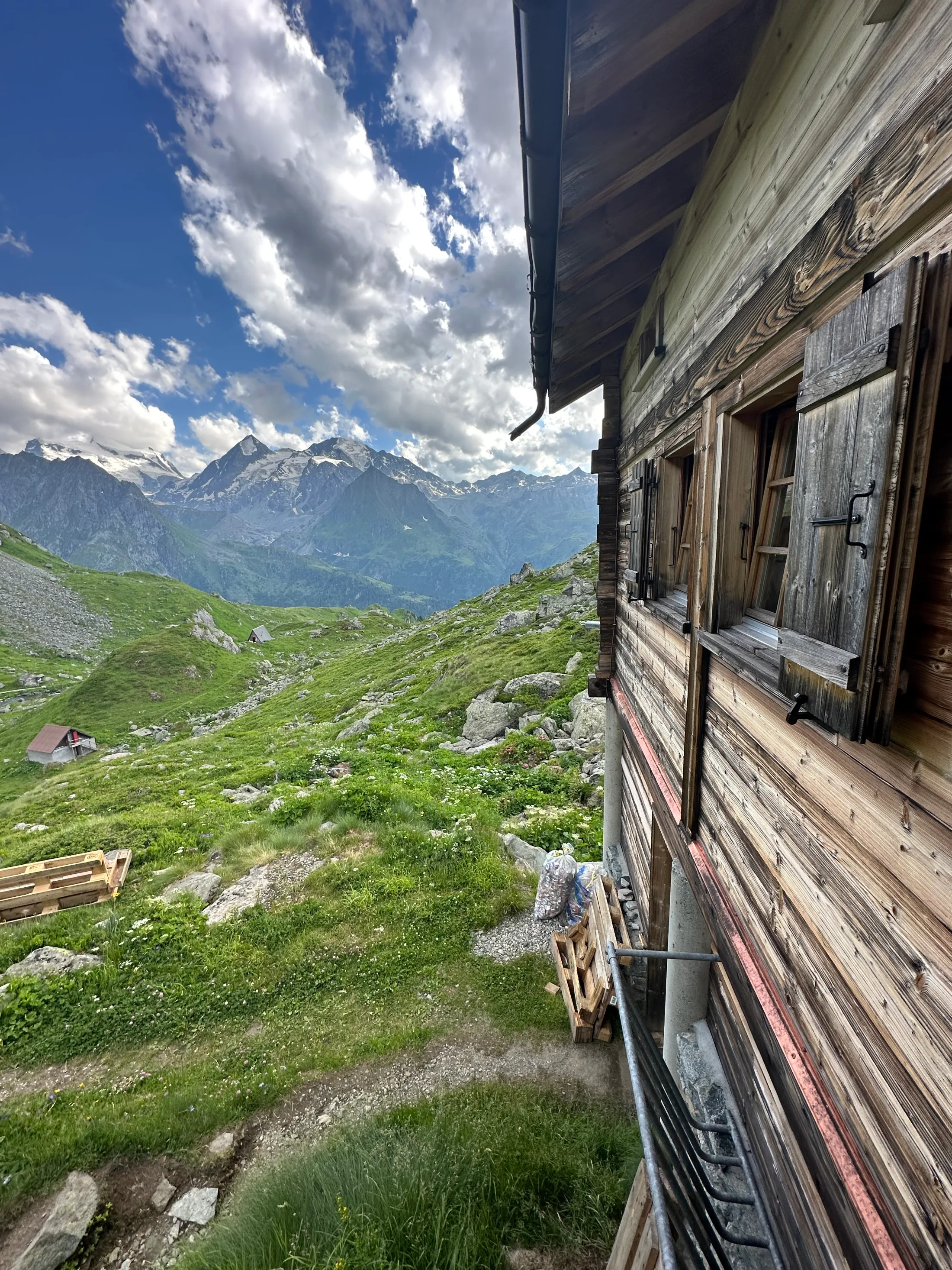
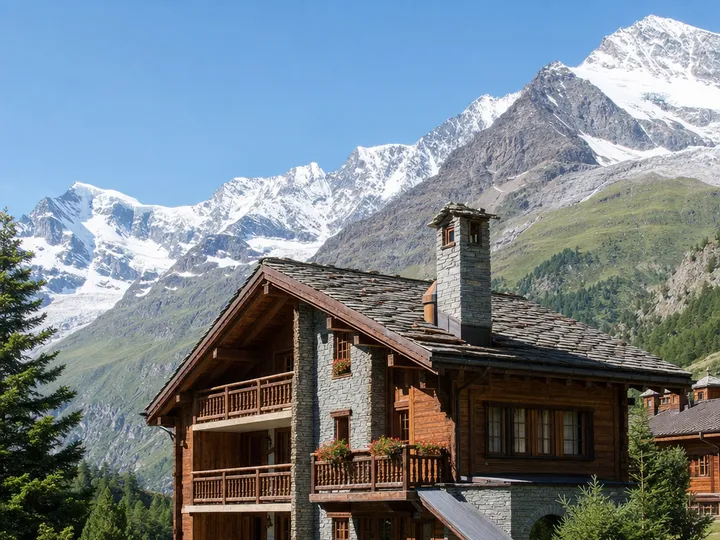
The Swiss half of the great Chamonix-to-Zermatt traverse, walked hut to hut over seven days and seven passes: the Sentier des Chamois, the Prafleuri boulder-fields, the Pas de Chèvres ladders, Lac de Moiry, the Forcletta and the Augstbordpass, to a Matterhorn finish at Zermatt.
The Walker's Haute Route is the long way round between the two most famous mountains in the Alps. It runs from Chamonix under Mont Blanc to Zermatt under the Matterhorn, and unlike the glacier-bound skiers' route that shares its name, it stays on footpaths the whole way, climbing over a chain of high passes through the Valais. We walked the Swiss half of it in July 2023, from Le Châble at the mouth of the Val de Bagnes to Zermatt: seven days, seven passes, and a hundred kilometres of up and down that never once felt like filler.
What makes it special is how little height it gives back for long. Most days you climb to a pass somewhere between 2,800 and 3,000 metres, drop the whole way to a valley for the night, and do it again the next morning. You sleep in cabanes and old village hotels, eat whatever the warden is cooking, and wake up in a new valley, often a new language, every day. This guide lays out the route as we actually walked it: the passes and the ladders, where we slept, and what we found growing and moving along the way.
▸ Trail summary
Walker’s Haute Route
Pennine Alps · Valais · Switzerland
100 kmdistance
7 dayson trail
+7,100 mascent
2,987 mhigh point
SevereJul–SepHut-to-hut · high alpine
Le Châble, 821 metres, Day 1. Gondola to Verbier, then the Sentier des Chamois.
Cabane de Louvie, 2,230 metres, Day 1. A lakeside refuge under the Grand Combin.
Cabane de Prafleuri, 2,624 metres, Day 2. Over Col de Louvie and the Grand Désert.
Arolla, 1,998 metres, Day 3. Lac des Dix and the Pas de Chèvres ladders; the night at La Sage.
Zinal, 1,675 metres, Day 4. Col de Torrent, Lac de Moiry and Grimentz.
Gruben, 1,822 metres, Day 5. Over the Forcletta into the Turtmanntal.
St Niklaus, 1,127 metres, Day 6. The Augstbordpass, then the long drop to the Mattertal.
Zermatt, 1,620 metres, Day 7. The Matterhorn finish.
Le Châble
Louvie
Prafleuri
Arolla
Zinal
Gruben
St Niklaus
Zermatt
The route
The walk runs west to east across the grain of the Pennine Alps, so every day is a climb out of one north–south valley, over a pass, and down into the next. From Le Châble you ride the gondola up to Verbier and step straight onto the high balcony of the Sentier des Chamois; from there it is Louvie, Prafleuri, Arolla, Zinal, Gruben and St Niklaus, one valley at a time, until the Mattertal opens up and the Matterhorn is finally in front of you. There is barely a flat kilometre on it. The reward for all that vertical is that you are almost never below the treeline when it counts, and the glaciers are with you the whole way.
Le Châble, 821 metres, Day 1. Gondola to Verbier, then the Sentier des Chamois.
Cabane de Louvie, 2,230 metres, Day 1. A lakeside refuge under the Grand Combin.
Cabane de Prafleuri, 2,624 metres, Day 2. Over Col de Louvie and the Grand Désert.
Arolla, 1,998 metres, Day 3. Lac des Dix and the Pas de Chèvres ladders; the night at La Sage.
Zinal, 1,675 metres, Day 4. Col de Torrent, Lac de Moiry and Grimentz.
Gruben, 1,822 metres, Day 5. Over the Forcletta into the Turtmanntal.
St Niklaus, 1,127 metres, Day 6. The Augstbordpass, then the long drop to the Mattertal.
Zermatt, 1,620 metres, Day 7. The Matterhorn finish.
Le Châble
Louvie
Prafleuri
Arolla
Zinal
Gruben
St Niklaus
Zermatt
▸ startfinish ⛰
100 km
distance
7 days
on trail
+7,100 m
ascent
2,987 m
high point
elev 821–2,624 m · 8 waypoints
Day by day
I arrived in Le Châble the afternoon before, straight off a week-long work offsite in Gdańsk and in no shape for what was coming. The town nearly beat me before I'd taken a step: my bank card had just expired and not a single machine would give me a franc. I spent that first night with a kind old lady in a tiny B&B who spoke no English, and me no French, and somehow we managed perfectly well. The next morning I met the group I'd walk the week with: a family with their two grown daughters and the father's two American brothers, two couples from Portugal, a gentle man from Mauritius who spoke no English but smiled at everyone, two Belgians on a brothers' trip away from the kids, and Mathieu, our guide from France.
Each evening Mathieu would sketch the next day on his iPad: the profile, the cols, the villages, where we might swim, the time we'd leave. The little route maps at the head of each day below are built in his spirit. The distances and ascents are honest but soft, and the shape is what matters anyway. A pass, a valley, a pass.
Day 1
Le Châble → Cabane de Louvie
13.4 kmdistance
+1,250 mascent
−530 mdescent
5–6 hwalking
Gondola to Verbier, then a high bisse-side balcony on the Sentier des Chamois through the Haut Val de Bagnes reserve, over Col Termin and down to the lake.
Elevation profile: Le Châble 821 m (start) → Verbier 1,500 m (gondola) → Col Termin 2,648 m → Lac de Louvie 2,213 m → Cabane de Louvie 2,230 m (night).
Le Châble821 mstart
Verbier1,500 mgondola
Col Termin2,648 m
Lac de Louvie2,213 m
Cabane de Louvie2,230 mnight
The day opened with a small crisis: my water bladder split before we'd even started, and only a tiny hiking shop in town, surely kept in business by exactly this kind of misfortune, saved the day. Then the gondola did the first 700 metres of climbing out of Le Châble to Verbier, which feels like cheating until you remember there are six more days of it to come. From the top the Sentier des Chamois traverses the Haut Val de Bagnes reserve, a real balcony path with the Grand Combin filling the sky to the south, and it lifts you straight into the high Alps on the very first afternoon. We reached Cabane de Louvie by mid-afternoon with time to unwind, and a few of us went in for a freezing swim in the lake beside the hut with the two American brothers. Dinner was a proper three courses, absurdly luxurious for somewhere so remote.
Day 1 · VerbierThe yellow Swiss signpost at Verbier, where the gondola lets you off and the walking begins.Col Termin2,648 mThe high point of the day on the Sentier des Chamois, with the first long view to the Grand Combin before the drop to the lake.Cabane de Louvie2,230 mA remote private refuge on a high shelf, sat right on the shore of Lac de Louvie. No phone signal, two-minute showers, and a very good plate of spaghetti.Day 1 · Lac de LouvieSnow peaks mirrored in Lac de Louvie, a few minutes' walk above the cabane.
Day 2
Cabane de Louvie → Cabane de Prafleuri
12 kmdistance
+1,120 mascent
−740 mdescent
5–6 hwalking
The most remote and pathless day: a stiff climb to Col de Louvie, a long crossing of the bouldery Grand Désert, then a final rocky pull over Col de Prafleuri.
Elevation profile: Cabane de Louvie 2,230 m (start) → Col de Louvie 2,921 m → Grand Désert 2,800 m → Col de Prafleuri 2,987 m → Cabane de Prafleuri 2,624 m (night).
Cabane de Louvie2,230 mstart
Col de Louvie2,921 m
Grand Désert2,800 m
Col de Prafleuri2,987 m
Cabane de Prafleuri2,624 mnight
This is the crux of the whole Swiss half, and the most serious day's walking on the route. There is no village, no road, and for long stretches no real path. From Louvie you climb to Col de Louvie, then pick your way across the Grand Désert, a high basin of boulders and scree below the glaciers, before the final scramble to Col de Prafleuri at 2,987 metres, the highest point you reach on the entire Haute Route. Take it slowly when snow is still lying. The hut is a short drop down the far side. Mathieu packed us a lunch each morning, and we shared out some of the group's supplies to carry, which made a day this remote feel a little less exposed.
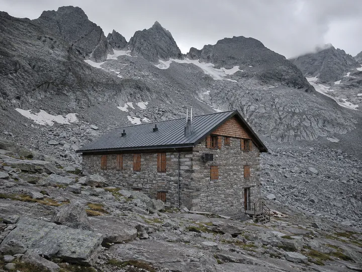
Day 2 · The Grand DésertPicking a line across the boulder fields of the Grand Désert, the route's most remote ground.Col de Louvie2,921 mThe first of the day's two big cols, gained over rough alpine terrain straight out of the Louvie basin.Col de Prafleuri2,987 mThe roof of the walk. A final rocky climb crowns the Grand Désert crossing before the hut comes into view.Cabane de Prafleuri2,624 mA busy, functional hut built from the old Grande Dixence dam-workers' barracks. The only water is glacier meltwater, so buy or purify it, and expect ibex at the salt licks around dinner.
Day 3
Cabane de Prafleuri → La Sage
19 kmdistance
+850 mascent
−1,500 mdescent
7–8 hwalking
Over Col des Roux into the Dix basin, the length of the Lac des Dix reservoir, then the Pas de Chèvres ladders over the Glacier de Cheilon, down to Arolla and on to La Sage.
Elevation profile: Prafleuri 2,624 m (start) → Col des Roux 2,804 m → La Barma 2,458 m → Lac des Dix 2,364 m → Pas de Chèvres 2,855 m → Arolla 1,998 m → La Sage 1,667 m (night).
Prafleuri2,624 mstart
Col des Roux2,804 m
La Barma2,458 m
Lac des Dix2,364 m
Pas de Chèvres2,855 m
Arolla1,998 m
La Sage1,667 mnight
The longest day, and the most varied. A short climb over Col des Roux drops you into the great basin of Lac des Dix, and then there is a long, flat, slightly hypnotic walk along the full length of the reservoir behind the Grande Dixence, the tallest gravity dam in Europe. At the far end the trail rears up to the Pas de Chèvres, which you cross on a set of fixed steel ladders and catwalks bolted to the cliff above the Glacier de Cheilon. From the col it is a long descent to Arolla and on down the Val d'Hérens to a bed at La Sage. By now the lack of conditioning was catching up with me and the body was properly sore, but a day with this much in it leaves little room to dwell on it.
Day 3 · Lac des DixThe milky turquoise length of Lac des Dix, a flat hour or two behind the Grande Dixence dam.Day 3 · Pas de ChèvresThe steel ladders dropping off the Pas de Chèvres, with the Glacier de Cheilon below.
Lac des Dix2,364 mA long turquoise reservoir held back by the Grande Dixence; a flat, easy shoreline walk after the morning's col.Pas de Chèvres2,855 mCrossed on rebuilt fixed ladders above the glacier. They were open and in use when we walked in 2023.
Worth knowing if you are planning this now: the Pas de Chèvres ladders were closed for good from the summer of 2024 after rockfall and thawing permafrost made them unsafe. The standard crossing today is the neighbouring Col de Riedmatten (2,919 m), a steep, chained scramble of loose ground a little to the north. The day is otherwise unchanged.
Day 4
La Sage → Zinal
14.5 kmdistance
+1,300 mascent
−1,380 mdescent
6–7 hwalking
A long climb to Col de Torrent, a descent past the Lac de Moiry dam to the storybook village of Grimentz, then on into the Val d'Anniviers toward Zinal.
Elevation profile: La Sage 1,667 m (start) → Col de Torrent 2,916 m → Lac de Moiry 2,249 m → Grimentz 1,570 m → Zinal 1,675 m (night).
La Sage1,667 mstart
Col de Torrent2,916 m
Lac de Moiry2,249 m
Grimentz1,570 m
Zinal1,675 mnight
By the fourth day the body had stopped complaining and found its rhythm, which was just as well, because this is a big, scenic crossing into the next valley system. The climb from La Sage to Col de Torrent is long and steady, one of the highest passes of the route, and the drop on the far side brings you out above the vivid turquoise of Lac de Moiry. From the dam the trail winds down to Grimentz, a beautifully kept Anniviers village of sun-blackened timber chalets, geraniums and a working water wheel, before the last leg up the valley toward Zinal under its crown of 4,000-metre peaks. Coming down into these little villages at the end of a high day was a reward all of its own.
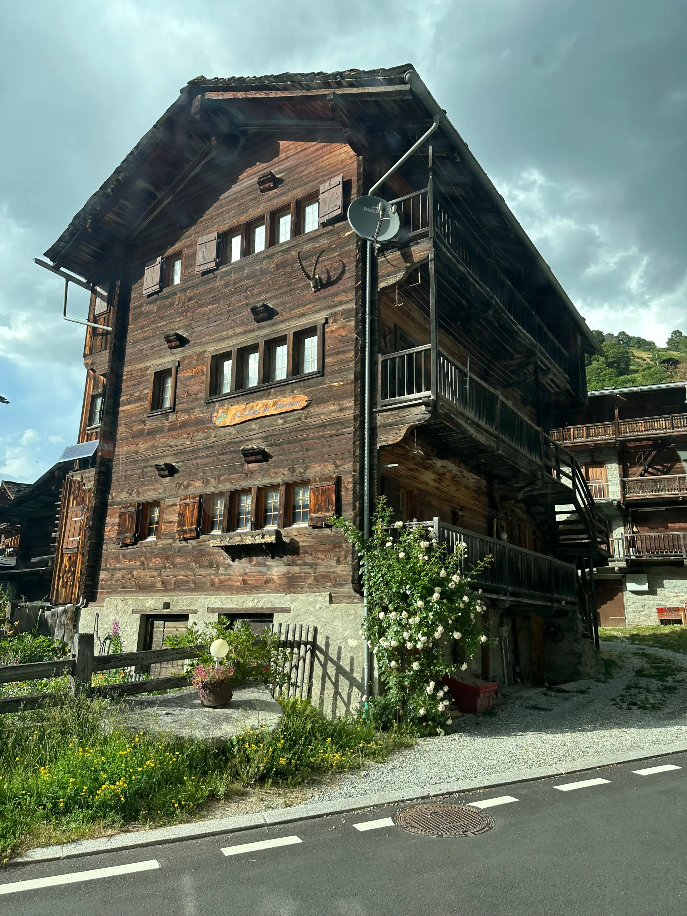
Day 4 · Lac de MoiryLac de Moiry held back by its dam, reached on the long descent from Col de Torrent.Day 4 · GrimentzGeranium-clad mazots in Grimentz, one of the best-preserved timber villages in the Valais.Col de Torrent2,916 mA long pull up from La Sage to one of the highest passes on the route, with a rocky rest viewpoint on the way.Lac de Moiry2,249 mA glacier-fed reservoir ringed by moraine, the scenic heart of the day before the drop to Grimentz.
Day 5
Zinal → Gruben
16.6 kmdistance
+1,255 mascent
−1,090 mdescent
6–7 hwalking
Out of Zinal and up the valley side to the rocky Forcletta, then down past alpine farms into the remote Turtmanntal at Gruben.
Elevation profile: Zinal 1,675 m (start) → Forcletta tarn 2,600 m → Forcletta 2,874 m → Turtmann view 2,100 m → Gruben 1,822 m (night).
Zinal1,675 mstart
Forcletta tarn2,600 m
Forcletta2,874 m
Turtmann view2,100 m
Gruben1,822 mnight
The day you cross the language border. The climb out of Zinal leads up to the Forcletta, a rocky notch where French-speaking Valais gives way to German, and where a small tarn just below the col gave us the best swim of the trip. After a gruelling morning it was the perfect reset, and the real joy was talking the rest of the group into it and watching them light up after the plunge. The descent then runs past the hanging Turtmann glacier and down into the Turtmanntal, one of the most remote and least-developed valleys on the whole walk, to the tiny summer-only hamlet of Gruben.
Day 5 · near the ForclettaThe best swim of the trip: a glacier-fed tarn below the pass, with the Matterhorn a tiny silhouette away to the south.Day 5 · TurtmanntalThe Turtmann glacier spilling off the face, feeding the waterfalls above Gruben.
Forcletta2,874 mA rocky pass marking the French–German language border of the Valais; windy on the approach.Gruben (Hotel Schwarzhorn)1,822 mA summer-only hamlet in the Turtmanntal with one hotel and no shop. Nearly every Haute Route walker stops here, so book early.
Day 6
Gruben → St Niklaus
16.5 kmdistance
+1,135 mascent
−1,770 mdescent
7 hwalking
The last big pass: a steady climb to the broad, windswept Augstbordpass, a boulder-field traverse, then a knee-testing 1,700 m descent via Jungen to the Mattertal.
Elevation profile: Gruben 1,822 m (start) → Augstbordpass 2,894 m → Twära 2,400 m → St Niklaus 1,127 m (night).
Gruben1,822 mstart
Augstbordpass2,894 m
Twära2,400 m
St Niklaus1,127 mnight
The final pass, and the longest descent of the trip. A steady climb from Gruben gains the Augstbordpass, wide and stony and usually breezy, the last of the seven cols. The reward comes a little lower at the Twära viewpoint above Jungen, where the Mattertal suddenly opens out beneath you for the first time, and then, out of a more or less clear sky, we got pelted with hail. The weather up here turns in minutes. Then it is down, and down, and down: 1,700 metres through the shrines of Jungen and the forest to St Niklaus on the valley floor. It was a gruelling descent and my knees knew about it, but by now the body was holding up and I'd found my stride.
Day 6 · above the MattertalThe deep trench of the Mattertal opening up on the long descent from the Augstbordpass.Augstbordpass2,894 mThe seventh and last high pass of the walk, broad and stony, often into a headwind on the climb.St Niklaus1,127 mA small valley town in the Mattertal at the foot of the descent; the last proper supermarket and ATM before Zermatt.
Day 7
St Niklaus → Zermatt
7 kmdistance
+200 mascent
1–2 hwalking
A short transfer up the Mattertal to Zermatt under the Matterhorn. Most walkers take the train; the walking alternative is the two-day Europaweg.
Elevation profile: St Niklaus 1,127 m (start) → Zermatt 1,620 m (by train).
St Niklaus1,127 mstart
Zermatt1,620 mby train
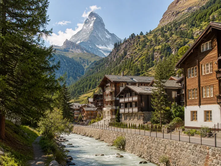
We took the valley train for the last hop up to Zermatt, as most walkers do. The walking alternative is the Europaweg, a spectacular but committing two-day high route along the eastern wall of the Mattertal, complete with the Charles Kuonen suspension bridge, and it does not fit a single celebration evening. The prize is the same either way: stepping out into car-free Zermatt with the Matterhorn standing clear at the head of the valley. I peeled off from the group when we arrived and went after the side trip I'd been quietly building up to all week: summiting the Breithorn, 4,164 metres, with a mountain guide, an accessible glacier 4000er straight above the town. That evening I found the others again for a final meal of Swiss cheese fondue with the American brothers I'd grown close to over the week. It is very hard not to grin walking into Zermatt under the Matterhorn, and harder still after a day on a 4000-metre summit.
Day 7 · ZermattRösti and wine in Zermatt, the traditional and entirely non-negotiable end to the walk.Day 7 · ZermattThe Matterhorn against a clear sky, the finish line you have been walking toward for a week.
Zermatt1,620 mJourney's end beneath the Matterhorn. Car-free, expensive, and worth every franc after seven days of passes.
Side trips
The Walker's Haute Route is non-technical from end to end, but it threads through serious mountaineering country, and there are several ways to make it bigger if you have the skills and the days. The first is a hiking variant; the last is a gentle victory lap. The two in the middle are real mountaineering, with glaciers and the gear and competence that implies.
Side-quest · optional
The Sentier des Bouquetins
+2 km+150 m1–1.5harder
Instead of the standard climb to the Pas de Chèvres or Col de Riedmatten, the Sentier des Bouquetins traverses the lateral moraine and rock terraces high above the Glacier de Cheilon before rejoining the route on the descent to Arolla. It is exposed and rough underfoot, waymarked but with a few fixed-cable steps, and best kept for dry conditions and a settled forecast. Now that the Pas de Chèvres ladders have gone, this is the connoisseur's high line for confident scramblers.
Payoff Trade the ladders-or-scree col for an airy glacier-edge balcony with the closest views of Mont Blanc de Cheilon and the Pigne d'Arolla on the whole day.
Side-quest · optional
Pigne d'Arolla (3,796 m)
+11 km+1,750 ma full extra daymuch harder
From Arolla you can divert up to the spectacularly perched Cabane des Vignettes at 3,158 m, sleep there, and climb the Pigne d'Arolla at dawn. The summit is graded easy snow and is not hard in the technical sense, but it is genuinely glaciated, with hidden crevasses the whole way. This is mountaineering, not hiking: rope, crampons, ice axe and the skills to use them, or an IFMGA guide. The 2018 storm fatalities on this very segment are a sobering reminder of what the weather can do up here.
Payoff The highest summit reachable from the route, with a 360-degree sweep over the Dent Blanche, the Grand Combin and the Matterhorn.
Side-quest · optional
The Breithorn (4,164 m)
+6 km+300 mhalf a daymuch harder
The Breithorn is the most accessible 4,000-metre peak in the Alps, and the obvious way to cap the walk if you have the legs and a clear day. From Zermatt the Klein Matterhorn cable car lifts you to 3,883 m; from there it is a roped glacier plod and a final snow slope to the summit at 4,164 m, about two to three hours return at the easy alpine grade F. It is non-technical but fully glaciated and at real altitude, so you go with a guide and the full kit: rope, crampons, ice axe, harness. I climbed it with a guide on the last day, after the group had gone its separate ways in Zermatt, and it was the perfect full stop to the week.
Payoff An accessible glacier 4000er straight off the finish line: your first big summit, with the Matterhorn across the valley.
Side-quest · optional
Gornergrat, Riffelsee & Fluhalp
+10 km+250 m3–4no harder
Rather than finishing tamely in Zermatt, spend a bonus day on the classic viewpoint circuit above the valley. The 5-Seenweg strings together a chain of small lakes where, on a still morning, the Matterhorn mirrors perfectly; Fluhalp makes a fine lunch with the peak filling the window. For the most head-on reflection of all, ride the Gornergrat railway and walk down past the Riffelsee. It is easy, lift-served walking and a fitting victory lap.
Payoff Cap the walk with the postcard Matterhorn reflections instead of dropping straight into town.
Where you sleep
There are no campsites to plan around on this route: you sleep indoors every night, in mountain cabanes high on the passes and in old hotels down in the villages. The two cabanes are the real flavour of the trip. You carry a sleeping-bag liner rather than a bag, the warden cooks a set dinner, and lights go out early. Book everything ahead in July and August, and carry Swiss francs, because several of these places are cash only when the signal drops.
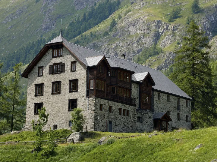
Cabane de Louvie
2,230 m
Hut
54 bedswatermeals
A remote, off-grid refuge on a high shelf of the Val de Bagnes, perched right by Lac de Louvie with a head-on view of the Grand Combin. No Wi-Fi, no signal, and all the better for it.
Booking: Private hut; reserve via reservation.louvie.ch
Cabane de Prafleuri
2,624 m
Hut
59 bedsmeals
A functional hut in a stony basin near the Grande Dixence, built from the old dam-workers' barracks. The only water is glacier meltwater, so buy bottled or purify.
Booking: CAS-affiliated; staffed Jul–Sep, winter room always open
Hôtel de la Sage
1,667 m
Hotel
40 bedswatermeals
A friendly, recently renovated village hotel on the square at tiny La Sage, on a quiet balcony above Les Haudères, with a bakery and bus stop at the door.
Booking: Book direct; ensuite rooms
Hôtel de la Poste, Zinal
1,675 m
Hotel
30 bedswatermeals
A traditional village hotel in Zinal, the biggest resort on the route, sat at the head of the Val d'Anniviers under the Imperial Crown of the Weisshorn and the Zinalrothorn.
Booking: Book ahead for Jul–Aug; several other options in town
Hotel Schwarzhorn, Gruben
1,822 m
Hotel
40 bedswatermeals
The sole hotel in summer-only Gruben, deep in the remote Turtmanntal. Doubles and dorms, a set four-course dinner, weak Wi-Fi and no shop. Nearly everyone has to stay here, so it fills first.
Booking: Book EARLY; the only lodging in the valley
Zermatt
1,620 m
Hotel
200 bedswatermeals
The car-free finish under the Matterhorn, with the full range of beds for a well-earned recovery night.
Booking: Everything from dorms to five-star; book ahead, budget for Swiss-resort prices
Landmarks
You measure your progress on this walk against a procession of giants. The Grand Combin watches the first days, the Matterhorn the last, and in between the route threads past some of the most recognisable rock and ice in the Alps.
Grand Combin
4,314 mS over the first Swiss stages
The huge glaciated massif that fills the southern sky from the Sentier des Chamois and the climb above Louvie, the route's first great 4,000-metre presence after Mont Blanc.
Lac des Dix & the Grande Dixence
2,364 mThe basin at the heart of the route
A long turquoise reservoir held back by the Grande Dixence, the tallest gravity dam in Europe. The full-length shoreline walk is the flat, strange centrepiece of day three.
Mont Blanc de Cheilon
3,870 mS, head of the Dix basin
The dark pyramid that closes the Cheilon valley, the defining backdrop above Lac des Dix and the glacier the ladders drop beside.
Pigne d'Arolla
3,796 mS above Arolla
A broad snow dome over Arolla and the highest summit reachable from the route, for those equipped to cross its glaciers.
Lac de Moiry
2,249 mOn the descent from Col de Torrent
A vivid turquoise glacial reservoir ringed by moraine, the scenic high point of the day four crossing into the Val d'Anniviers.
Weisshorn
4,506 mSE over Zinal and the Forcletta
The soaring snow pyramid that dominates the eastern half of the walk from Zinal onward, and the namesake of the historic Hotel Weisshorn balcony above it.
Matterhorn
4,478 mS up the Mattertal
The unmistakable horn that is the walk's emotional finish line, hidden until the Augstbordpass and then filling the whole head of the valley at Zermatt.
What grows here
July puts the Valais slopes through their whole flowering year at once. The subalpine zone is a sheet of alpenrose, the pass meadows are studded with gentian, and right up at the cold edge of the snow you find the toughest specialists of all. Stay on the path: the high turf is slow-growing and easily scarred.
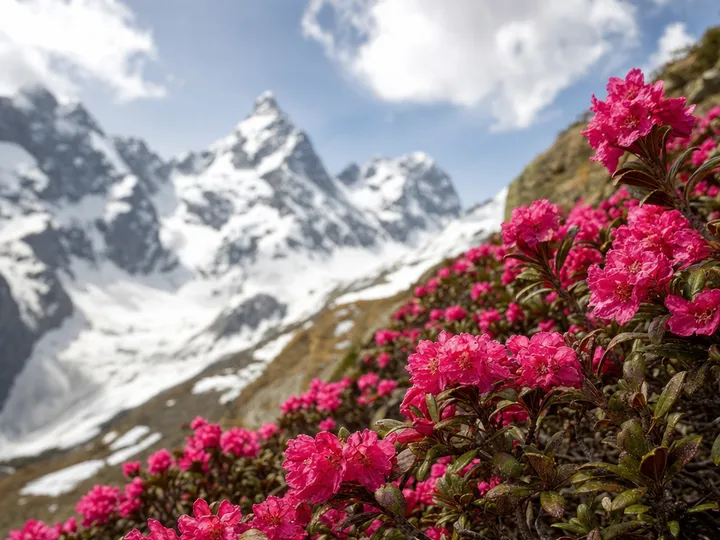
Alpenrose
Rhododendron ferrugineum
Peak early–mid JulyAcid heath and larch woods, 1,600–2,300 m
The rust-leaved alpenrose carpets the lower slopes of nearly every stage in July, its dense crimson masses the most conspicuous flower of the whole trek.
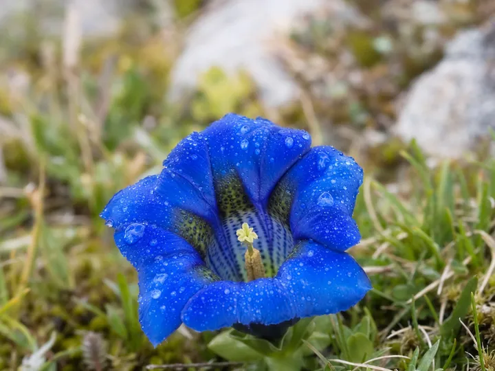
Trumpet gentian
Gentiana acaulis
Through JulyShort turf on the passes, 2,000–2,800 m
Almost luminous deep-blue trumpets, sitting flush on the cropped pasture of Col Termin, Col de Torrent and the Forcletta. Unmistakable against the green.
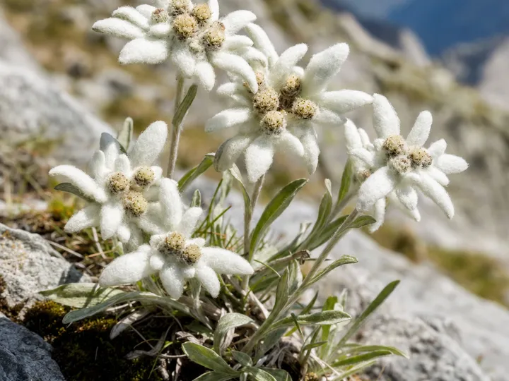
Edelweiss
Leontopodium nivale
Mid-July to AugustRock crevices off the Forcletta and Augstbordpass
Switzerland's woolly star-flower is genuinely localised here. The Turtmann side is the route's most reliable spot, but you have to look low among the rocks.
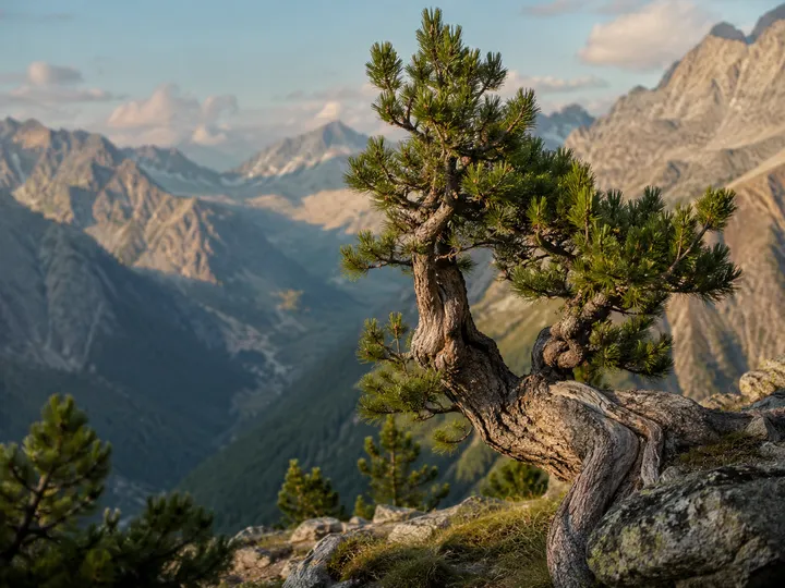
Arolla pine
Pinus cembra
Year-roundTreeline woods around Arolla and Gruben
The route literally passes through the Arolla valley the tree is named for. A five-needled stone pine that lives a thousand years, its seeds sown by the spotted nutcracker.
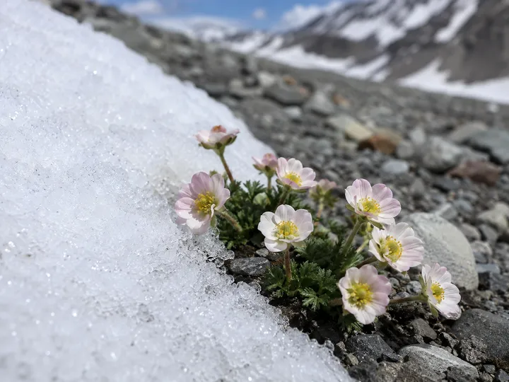
Glacier buttercup
Ranunculus glacialis
July, beside melting snowThe Grand Désert and the high cols, above 2,600 m
One of the highest-flowering plants in the Alps, its white-to-pink blooms appearing within metres of the retreating snow on the barren high ground.
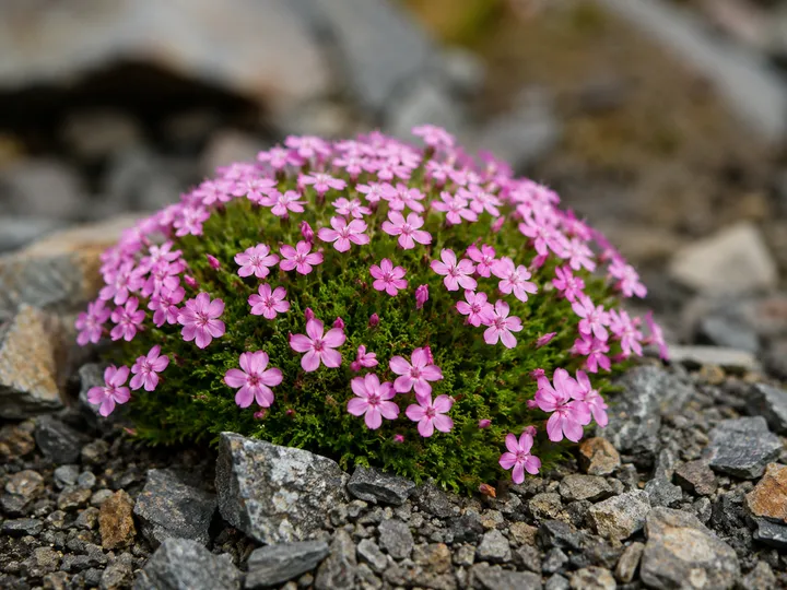
Moss campion
Silene acaulis
Early–mid JulyWind-exposed pass tops and scree margins
Tight green cushions spangled with pink stars, growing on the most exposed, gravelly ground of the passes where almost nothing else will.
What lives here
The big animals here are not shy in the way Australian wildlife is. Ibex and chamois hold the high crags in plain sight, marmots whistle from every boulder field, and the pass tops belong to the choughs. With luck and an early start you might even catch the route's rarest resident riding the morning air.
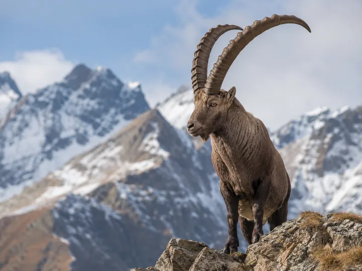
Alpine ibex
Capra ibex
commonThe high western stages; the Prafleuri salt licks
Reintroduced to the Val de Bagnes in 1926, these massive scimitar-horned wild goats are near-guaranteed on the high crags, and often loaf around Cabane de Prafleuri at dinner time.
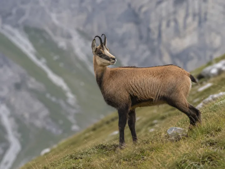
Chamois
Rupicapra rupicapra
commonForest edge and steep slopes, route-wide
The agile goat-antelope that gives the Sentier des Chamois its name, seen on nearly every stage where forest meets crag, most active around dawn.
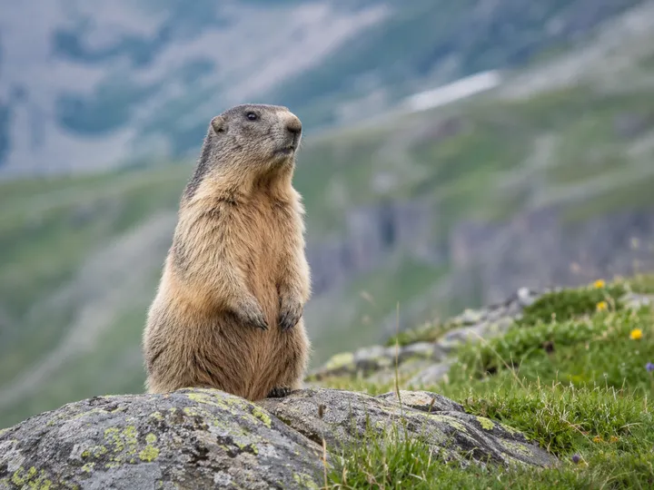
Alpine marmot
Marmota marmota
commonBoulder fields and pasture everywhere
You hear the sharp alarm whistle long before you see one. Colonies dot the meadows along Lac des Dix and the pass approaches, fattening up all July for the long winter.
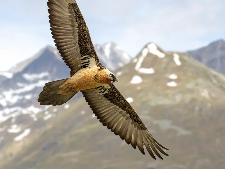
Bearded vulture
Gypaetus barbatus
rareSoaring over the high ridges and cirques
Exterminated in Switzerland in the 19th century and reintroduced from 1986, this 2.6-metre bone-eater is the largest bird in the Alps and an unforgettable, lucky sighting.
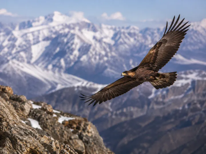
Golden eagle
Aquila chrysaetos
occasionalQuartering the ridges, hunting above the treeline
Resident pairs hold territories the length of the Pennine Alps. Watch for the broad, fingered wings and the shallow-V soar over the cols when the thermals build.
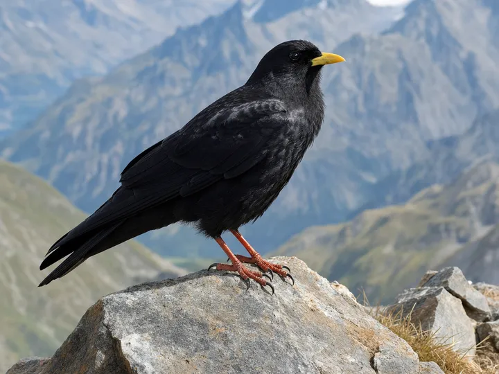
Alpine chough
Pyrrhocorax graculus
commonEvery high pass and hut terrace
Glossy black with a yellow bill and red legs, these acrobatic crows mob the pass tops and hut terraces the moment you stop to eat.
Gear
This is a hut-to-hut walk, so the pack is lighter than a tent trek: no shelter, no full sleeping bag, no five days of food. What it is not is casual. You carry full waterproofs and warm layers every single day, because the cols make their own weather, and you carry the small hut-specific items that make a shared dormitory bearable. The single rule: pack for a storm even in a heatwave.
Gear
Worn
Worn-in boots with ankle supportessentialLong, loose, rocky descents on nearly every stage; break them in well before you start.
Trekking polesessentialEffectively mandatory here. This is a hard route on the knees, with 1,500–1,700 m descents into Arolla, Zinal and St Niklaus.
Layered clothing — base, fleece, insulated jacketessentialThe weather flips fast above the treeline; a synthetic puffy keeps warming even when damp.
Sun hat, category 3–4 sunglasses, high-SPF creamessentialFierce UV at altitude with snow reflection, and little shade on the cols. Reapply on the long climbs.
In the pack
Sleeping-bag liner (sac à viande)essentialThe route-specific item. The cabanes supply mattress and duvet; you sleep inside your own liner as a hygiene layer. Silk packs to a fist.
Cash in Swiss francsessentialLe Châble to Zermatt is Swiss only, so francs, not euros. Several huts, lunches and buses are cash only when the signal drops. Allow CHF 80–110 a night for half-board.
Hut slippersessentialBoots are banned indoors in every cabane and most hotels. Many lend Crocs, but a packable pair guarantees a fit.
EarplugsessentialWarm, full July dormitories, snorers, and 5am alpine starts. Genuinely the difference between sleeping and not.
HeadlampessentialFor pre-dawn departures and dim dorms; move without waking the room. Arrive charged, as hut outlets are scarce.
Full waterproofs (jacket and trousers)essentialCarried every day regardless of forecast; the high cols expose you to fast storms and cold rain even in a heatwave.
~2 L water capacity + purificationessentialLong waterless high stretches between huts; tablets or a filter back up uncertain sources up top.
Microfibre towelHuts charge for or don't supply towels; a quick-dry one makes the hut shower worthwhile and dries you after a lake dip.
Safety
First-aid and blister kitessentialSelf-sufficient between huts; the long descents shred feet, so blister care is the most-used item. Pack personal meds.
Offline map (SwitzerlandMobility) + Cicerone guideessentialCarry the SuisseMobile route data offline and Reynolds' Cicerone guide for stage detail. Know the Pas de Chèvres / Col de Riedmatten situation before the Arolla day.
Power bank + Swiss type-J adapterCharging at huts is limited and sometimes paid; a power bank keeps phone and GPS alive across the cabane nights.
Optional
Quick-dry swimwearFor Lac de Louvie below the cabane, the Forcletta tarn and Lac de Moiry. Snow-melt cold, so swim brief and dry fast.
The Walker's Haute Route rewards the walker who comes fit, packs for worse weather than they get, and treats each pass as the day's real summit. Book the cabanes early, carry francs and a liner, save the Bouquetins variant and the lake swims for the clear days, and let the long descents be the price of all that height. Seven days later you walk into Zermatt under the Matterhorn, and it is very hard not to grin.
The finish · Fluhalp, above ZermattThe Matterhorn framed by the signpost at Fluhalp, on the bonus day above Zermatt. The end of a very good week.